The desert · 5 min read沙漠 · 约 5 分钟
Mangystau: the dry floor of an ancient sea曼格斯套:远古海洋干涸的海底
Tethys Ocean chalk, stone balls, salt flats, the Fangs of Bozzhyra, the Tiramisu hills, and a desert of 362 saints.特提斯海的白垩、石球、盐滩、博兹日拉的“獠牙”、“提拉米苏”山,还有一片供奉着 362 位圣人的荒漠。
Mangystau, the peninsula and province around Aktau on the eastern shore of the Caspian, is one of the strangest landscapes on the planet. It looks like the surface of another world: white chalk cliffs, pink and ochre striped hills, fields of stone spheres, salt pans that shimmer into mirages. Almost everything you'll see on the three-day tour has the same explanation. You are standing on the floor of a vanished ocean.
The Tethys Ocean
For much of the age of the dinosaurs and after, a broad sea called the Tethys lay between the ancient continents of Laurasia to the north and Gondwana to the south. Over tens of millions of years its warm, shallow waters laid down thick layers of sediment: chalk and limestone made from the shells of microscopic plankton, marls and clays, bands stained red and yellow by iron.
As Africa and India pushed north, the Tethys closed. Its remnants survive as the Mediterranean, the Black Sea and the Caspian. In Mangystau the old seabed was lifted up, dried out and then attacked for millions of years by wind, occasional rain, and huge swings between hot and cold. The softer layers wore away and the harder ones stayed, leaving cliffs, mesas, towers and stripes. Walk the slopes below the cliffs at Tuzbair or Bozzhyra and you may find fossil shark teeth and sea urchins.
The broad tableland that the region's cliffs belong to is the Ustyurt Plateau, a slab of desert stretching east into Uzbekistan. Its edge, the chink, is a dramatic escarpment up to a few hundred meters high, and many of the sites on this trip sit at or beneath it. Nearby, the Karagiye Depression drops to about 132 meters below sea level, one of the lowest points on Earth.
The stops
- Torysh, the Valley of Balls. A steppe valley scattered with hundreds of nearly perfect stone spheres, some small enough to hold and some taller than a person. They are concretions: minerals cemented around a small core, such as a shell fragment, inside soft sediment, growing outward layer by layer. When the soft rock eroded, the hard balls were left lying on the surface. Estimates of their age vary widely, from tens of millions of years upward.
- Airakty, the Valley of Castles. A range of flat-topped limestone mountains (also called Airakty-Shomanai) whose cliffs are carved into turrets, walls and battlements. The Ukrainian poet Taras Shevchenko, exiled to a fort on the Mangystau coast in the 1850s, is credited with the "Valley of Castles" name. He sketched the region extensively.
- Tuzbair. A salt flat roughly 15 km long, ringed by white chalk cliffs about 60 meters high. The cliffs are riddled with arches, caves and wind-sculpted fins. One of them is the much-photographed "Dragon's Eye." After rain the salt floor can hold a thin mirror of water; in dry weather it throws mirages.
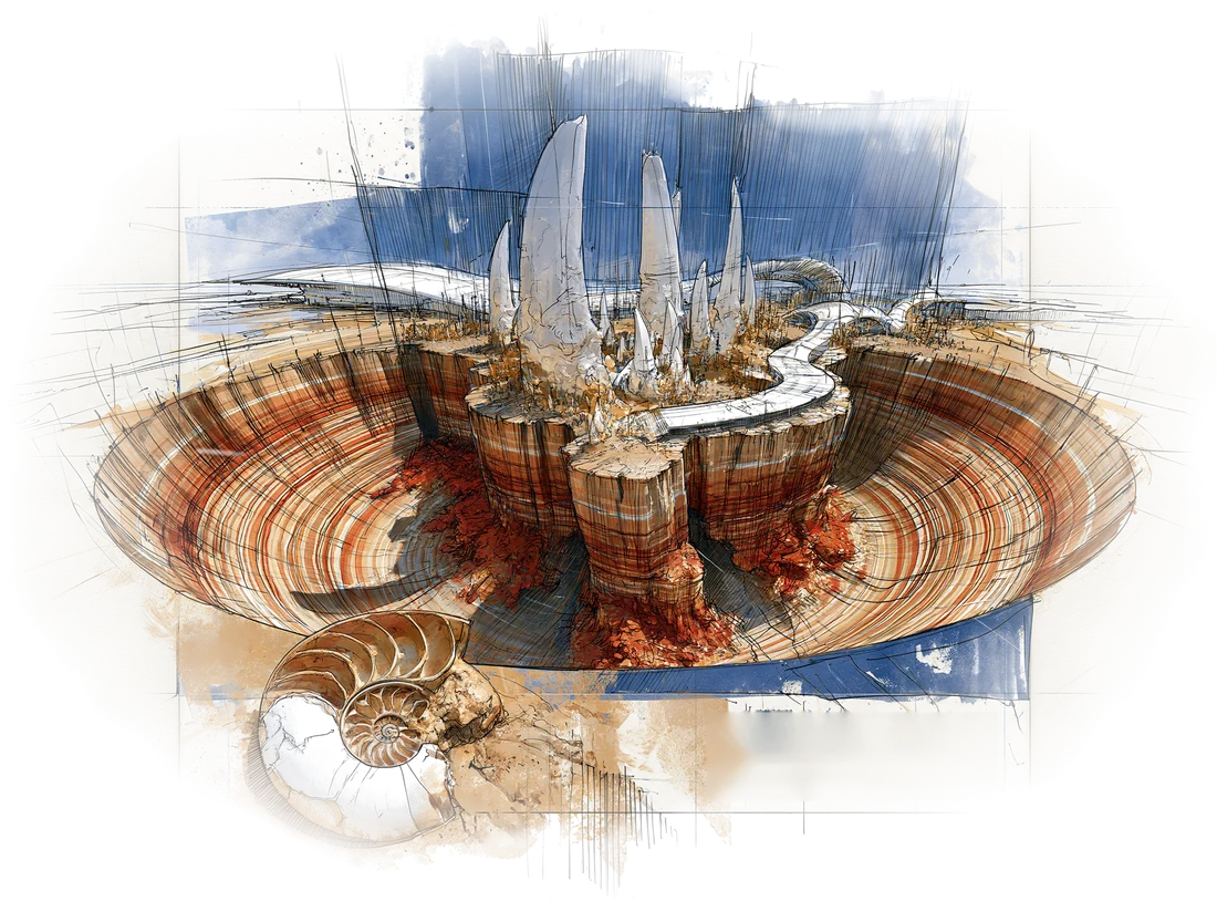
- Bozzhyra. The region's signature view. A vast bowl below the Ustyurt escarpment, with two white limestone peaks, the "Fangs," rising from the valley floor, and mesas stretching toward the horizon. Day 4's camp is pitched right here below the Fangs, and there's nowhere better to watch the light change at sunset and dawn.
- Kyzylkup and Bokty. Kyzylkup (kyzyl means red in Kazakh) is a cluster of low hills banded in white, pink, ochre and rust, the layers of chalk and iron-rich clay exposed like cake. Everyone calls it "Tiramisu." Nearby Bokty Mountain is a single tall mesa with the same stripes.
- Ybyq. A smaller gorge on the tour, often combined with the other sites. Expect narrow walls and more layered rock.
A holy desert
Mangystau is not empty of people or meaning. It's said to hold 362 holy sites, one for almost every day of the year, and its tradition links them to disciples of the Sufi master Khoja Ahmed Yasawi. The most famous are the underground mosques cut into the chalk. Beket-Ata, about 280 km east of Aktau, was carved out in the 18th century by the Sufi teacher Beket Myrzagululy and is a major pilgrimage site. Shakpak-Ata, on the Tupkaragan peninsula north of Aktau, is one of the oldest, a cross-shaped cave mosque generally dated to around the 10th century. Shopan-Ata stands above a huge necropolis.
In July 2026 UNESCO inscribed the "Rock Mosques and Associated Sacred Sites of Mangystau" (Beket-Ata, Shopan-Ata, Karaman-Ata, Shakpak-Ata and Sultan-Epe) on the World Heritage List. Our tour doesn't center on them, but you'll pass old cemeteries with carved stone tombs and small shrines. They are still active sites, so be quiet and respectful, and ask before photographing anyone.
Aktau itself
Aktau ("white mountain") is a Soviet-built city, founded in the 1960s to serve uranium mining and oil. From 1964 to 1991 it was called Shevchenko. It has no street names: addresses are given by microdistrict, building and apartment number, so "12-5-40" is a real address. The Caspian shoreline in town is rocky, with a promenade and good sunsets.
Practical notes for the desert
- Water and sun. It's dry. Drink more than you think, wear sunscreen, and cover up.
- Temperature swings. Late September days can be warm, but desert nights get cold. Layers and a warm hat for camp.
- Offline everything. Signal disappears for long stretches. Download maps and entertainment in Aktau.
- Leave no trace. The chalk formations are fragile. Stay off the thin edges, and don't take stones from the protected areas.
Every cliff in Mangystau is a cross-section of an ocean that no longer exists.
曼格斯套,是阿克套周边、里海东岸的一片半岛和州,也是地球上最奇异的地貌之一。它看上去像另一颗星球的表面:白垩悬崖,粉色和赭色相间的条纹山丘,满地的石球,泛着蜃景的盐滩。三天行程里你看到的几乎一切,都能用同一句话解释:你正站在一片消失了的海洋的海底。
特提斯海
在恐龙时代的大部分时间里乃至之后,北边的劳亚古陆和南边的冈瓦纳古陆之间横着一片宽阔的海,叫特提斯海。数千万年间,温暖的浅海一层层沉积下厚厚的物质:由微小浮游生物外壳堆成的白垩和石灰岩,泥灰岩和黏土,还有被铁质染成红色、黄色的条带。
随着非洲和印度板块北移,特提斯海逐渐合拢。它的残余就是今天的地中海、黑海和里海。在曼格斯套,古老的海床被抬升、晒干,此后数百万年里又饱受风蚀、偶尔的雨水和剧烈冷热交替的侵袭。软的岩层被磨掉,硬的留了下来,于是有了悬崖、方山、石塔和条纹。在图兹拜尔或博兹日拉的崖下坡地上走走,说不定能捡到鲨鱼牙齿和海胆的化石。
这一带的悬崖都属于一块广阔的台地,叫乌斯秋尔特高原,一路向东延伸到乌兹别克斯坦。高原边缘称作 chink(陡崖),落差可达数百米,这趟行程里的许多景点就在陡崖之上或之下。附近的卡拉基耶洼地低于海平面约 132 米,是地球上最低的地点之一。
沿途各站
- 托雷什(石球谷)。 一条草原谷地,散落着数百颗近乎完美的石球,小的能托在手里,大的比人还高。它们是结核:在松软的沉积物里,矿物以一块贝壳碎片之类的小核为中心胶结起来,一层层向外长。后来软岩被侵蚀掉,硬邦邦的石球就留在了地表。关于它们的年龄说法不一,从几千万年起往上都有。
- 艾拉克特(城堡谷)。 一列平顶的石灰岩山(也叫艾拉克特-肖马奈),崖壁被雕琢成塔楼、城墙和垛口的样子。乌克兰诗人塔拉斯·舍甫琴科在 1850 年代被流放到曼格斯套海边的一座要塞,“城堡谷”这个名字据说就出自他。他在这一带画了大量速写。
- 图兹拜尔。 一片约 15 公里长的盐湖,四周环绕着约 60 米高的白色白垩崖。崖壁上布满拱门、洞穴和被风削成的石鳍,其中一处就是被拍烂了的“龙之眼”。雨后盐滩上会积一层薄薄的水,像镜子;天干时则会浮起蜃景。
- 博兹日拉。 这一带最具代表性的画面。乌斯秋尔特陡崖下一片巨大的盆地,两座白色石灰岩峰从谷底拔起,就是**“獠牙”**,远处的方山一直排到天边。第四天的营地就扎在“獠牙”脚下,看日落和日出时光线的变幻,没有比这更好的位置。
- 克孜勒库普和博克提山。 克孜勒库普(哈萨克语 kyzyl 意为“红”)是一簇低矮的山丘,白、粉、赭、锈红层层相叠,白垩与富铁黏土的地层像蛋糕切面一样裸露出来,大家都叫它**“提拉米苏”。旁边的博克提山**是一座孤零零的高大方山,也是同样的条纹。
- 伊贝克峡谷。 行程里一处较小的峡谷,常和其他景点连着走。窄窄的崖壁,更多层层叠叠的岩石。
一片神圣的荒漠
曼格斯套并非荒无人烟,也并非没有意义。据说这里有 362 处圣地,差不多一年里每天一处,当地传统把它们和苏菲大师霍贾·艾哈迈德·亚萨维的门徒联系在一起。最有名的是开凿在白垩岩里的地下清真寺。贝克特-阿塔位于阿克套以东约 280 公里,由苏菲导师贝克特·梅尔扎古卢勒在 18 世纪凿成,是重要的朝圣地。沙克帕克-阿塔在阿克套以北的图普卡拉甘半岛上,是最古老的之一,十字形的洞窟清真寺,一般认为建于 10 世纪前后。绍潘-阿塔则矗立在一大片墓地之上。
2026 年 7 月,联合国教科文组织将**“曼格斯套岩窟清真寺及相关圣地”**(贝克特-阿塔、绍潘-阿塔、卡拉曼-阿塔、沙克帕克-阿塔和苏丹-埃佩)列入《世界遗产名录》。我们的行程不以它们为主,但沿途会经过一些古老墓地,有雕花的石墓,也有小小的神龛。这些至今仍是在用的圣地,请保持安静和尊重,拍人之前先问一声。
阿克套这座城
阿克套(意为“白山”)是苏联建的城市,1960 年代为铀矿开采和石油而兴建,1964 至 1991 年间名叫舍甫琴科。这里没有街道名:地址按小区号、楼号、门牌号来写,“12-5-40”就是一个正经地址。城里的里海岸边多礁石,有一条滨海步道,日落很美。
荒漠实用提示
- 补水和防晒。 这里很干。水要比你以为的多喝,涂防晒,把皮肤遮起来。
- 温差。 九月下旬白天可能挺暖,但荒漠的夜里会冷。营地多穿几层,带顶保暖帽。
- 一切离线。 信号会长时间消失。地图和消遣的东西,在阿克套就下载好。
- 不留痕迹。 白垩地貌很脆弱。别踩薄薄的边缘,也别从保护区里带走石头。
曼格斯套的每一面悬崖,都是一片已不复存在的海洋的剖面。
Where this shows up on the trip行程里对应的日子