South Island · 5 min read南岛 · 约 5 分钟
Fiordland & Milford Sound峡湾国家公园与米尔福德峡湾
The southwest corner of the South Island is one of the wettest, steepest, least-touched places on Earth. Fiordland National Park, created in 1952, covers about 1.2 million hectares, making it New Zealand's largest national park. It's part of Te Wāhipounamu, a UNESCO World Heritage Area, and almost none of it can be reached by road. The one great exception is the Milford Road, and that's where we're going.
Carved by ice
During the ice ages, huge glaciers flowed down from the mountains toward the sea, grinding out deep, U-shaped valleys. When the ice melted and sea levels rose, the ocean flooded in. The result is fourteen fiords cut into the coast, with walls that rise almost vertically from the water and depths that often run deeper than the mouths, where the glaciers dropped their rubble.
Technically, Milford Sound is a fiord, not a sound (a sound is a river valley flooded by the sea). Early European sailors named it after Milford Haven in Wales, and the name stuck. Its Māori name is Piopiotahi, "a single piopio," after a now-extinct native thrush. In Māori tradition the fiords were carved by the god Tū-te-raki-whānoa with his adze, working from south to north. By the time he reached Piopiotahi he had perfected his technique, which is why it's the most beautiful of them all.
The fiord is about 15 km long. Its signature is Mitre Peak (Rahotu), which rises 1,692 m almost straight out of the water; it's often described as one of the tallest mountains on Earth to rise directly from the sea floor. Rudyard Kipling is often credited with calling Milford Sound the "eighth wonder of the world." Whether or not he actually said it, nobody who has seen it argues.
Rain is the point
Milford Sound gets somewhere around 6,500 mm of rain a year, which makes it one of the wettest inhabited places on the planet. It rains on roughly two days out of three. Don't be disappointed if it does. A clear day shows you the shape of the fiord; a wet day shows you hundreds of temporary waterfalls pouring off every cliff face, some of them blown back up into the air before they hit the water. Many locals think rain is the best way to see it.
All that rain has an odd effect on the water. Fresh water, stained tea-brown by tannins from the forest, floats in a layer on top of the salt water. It blocks so much light that deep-water creatures such as black coral grow unusually close to the surface. Look out for fur seals on the rocks, bottlenose dolphins, and, if you're lucky, the rare Fiordland crested penguin (tawaki).
The Milford Road
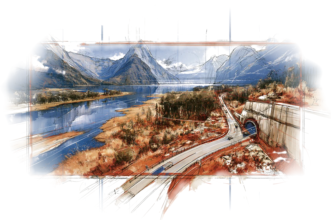
The only road into Milford is State Highway 94, about 120 km from Te Anau, and it's one of the great drives in the world. It runs up the Eglinton Valley past the mirror-still Mirror Lakes, through beech forest and open grassland, then climbs into a ring of granite walls toward the Homer Tunnel.
The tunnel took almost two decades to finish. Work began in 1935 during the Depression, with men using picks and wheelbarrows; avalanches killed workers, and the war interrupted it. It finally opened in 1953. It's about 1.27 km long, single-lane with traffic lights, unlined rock inside, and it drops steeply, about a 1-in-10 gradient, toward the Milford side. After the tunnel the road switchbacks down the Cleddau Valley to the sea.
Plan it carefully: allow at least two hours each way without stops, and more like three once you add photo stops, fill up in Te Anau (there's no fuel after that), and expect no cell signal for most of the way. Keep an eye out for kea, the cheeky alpine parrots that hang around the tunnel entrance and will happily take apart a rubber windshield seal. Don't feed them.
Te Anau
Te Anau is the gateway town, on the shore of Lake Te Anau, the largest lake in the South Island. It's a quiet, pretty base with motels, cafés and the last supermarket and gas station before Milford. Across the lake are the Te Anau glowworm caves, a young, still-forming limestone cave system reached by boat, with underground waterfalls and a grotto lit by thousands of glowworms. Te Anau is also where several of New Zealand's Great Walks begin, including the Milford, Kepler and Routeburn tracks.
Tips for the day
- Go early or late. Tour buses from Queenstown reach Milford around midday. An early start from Te Anau beats the rush and gives the best light.
- Take a boat. The fiord is best seen from the water; cruises run about two hours out to the Tasman Sea and back, past Stirling Falls and Lady Bowen Falls.
- Check the road. Rain, rockfall or avalanche risk can close SH94 without warning. Check the NZTA road status before setting out.
- Walk a little. The short foreshore walk at Milford and the Chasm on the Cleddau River (partly reopened after 2020 flood damage; check DOC for status) are both worth ten minutes.
A clear day shows you the shape of the fiord. A wet day shows you a thousand waterfalls.
南岛西南角,是地球上最潮湿、最陡峭、也最少被人碰过的地方之一。峡湾国家公园设立于 1952 年,面积约 120 万公顷,是新西兰最大的国家公园,也是联合国教科文组织世界遗产 Te Wāhipounamu(新西兰西南部)的一部分。这片土地几乎没有公路能进去,唯一的例外就是米尔福德公路,也正是我们要走的那条。
冰川刻出来的峡湾
冰河时期,巨大的冰川从山上往海里流,一路磨出又深又宽的 U 形谷。冰融化后海平面上升,海水倒灌进来,就成了今天海岸线上的十四道峡湾。崖壁几乎垂直地从水里拔起,湾里的水往往比湾口还深,因为冰川当年把碎石都卸在了出口处。
严格说来,米尔福德峡湾是峡湾(fiord),并不是英文名里说的“sound”(被海水淹没的河谷)。早期的欧洲水手照着威尔士的米尔福德港给它起了名,这个名字就一直沿用下来。它的毛利名叫 Piopiotahi,意思是“一只 piopio 鸟”,piopio 是一种已经灭绝的新西兰本土鸫鸟。毛利传说里,峡湾是神祇 Tū-te-raki-whānoa 用石斧一道道劈出来的,他从南往北干,干到 Piopiotahi 时手艺已臻化境,所以这一道最美。
峡湾长约 15 公里。它的招牌是麦特峰(Mitre Peak,毛利名 Rahotu),海拔 1692 米,几乎是从水面直直拔起,常被说成是世界上从海底直接耸起的最高山峰之一。常有人说吉卜林称米尔福德峡湾为“世界第八大奇迹”。这话他到底说没说过另当别论,亲眼见过的人都不会反驳。
雨,才是重点
米尔福德峡湾一年的降雨量大约在 6500 毫米上下,是地球上最潮湿的有人居住的地方之一,差不多三天里有两天在下雨。真赶上下雨,也不必失望。晴天让你看清峡湾的轮廓;雨天则让每一面崖壁都挂满临时瀑布,成百上千条,有的还没落到水面就被风吹回半空。不少当地人觉得,下雨才是看米尔福德最好的时候。
这么多雨水,给峡湾的水带来一个奇特的现象:被森林单宁染成茶褐色的淡水,浮在海水上面,形成一层“盖子”。它挡掉了大量光线,于是黑珊瑚这类原本生活在深海的生物,在这里离水面格外近。留意礁石上的软毛海豹、宽吻海豚,运气好的话,还能看到稀有的峡湾冠企鹅(tawaki)。
米尔福德公路
进米尔福德只有一条路:94 号国道,从蒂阿瑙出发约 120 公里,是世界上最美的自驾路线之一。公路沿埃格林顿河谷往上走,经过水平如镜的镜湖,穿过山毛榉林和开阔的草地,然后爬进一圈花岗岩绝壁围成的冰斗,直奔霍默隧道。
这条隧道前后修了将近二十年。1935 年大萧条时期开工,工人们靠镐头和手推车一点点凿;雪崩夺走过工人的性命,二战又让工程中断,直到 1953 年才正式通车。隧道长约 1.27 公里,单车道,靠红绿灯放行,洞壁是没有衬砌的裸岩,而且一路朝米尔福德那头往下倾,坡度约为 1:10。出了隧道,公路沿克莱多河谷盘旋而下,直抵海边。
这一天要好好规划:单程不停车至少两小时,算上拍照停车更接近三小时。在蒂阿瑙把油加满(过了蒂阿瑙就没有加油站),而且大半路程都没有手机信号。留意啄羊鹦鹉(kea),这种调皮的高山鹦鹉常在隧道口晃悠,很乐意帮你把车窗的橡胶密封条拆下来。千万别喂它们。
蒂阿瑙
蒂阿瑙是进峡湾的门户小镇,坐落在南岛最大的湖泊蒂阿瑙湖畔。小镇安静漂亮,有汽车旅馆、咖啡馆,还有去米尔福德之前最后一家超市和加油站。湖对岸是蒂阿瑙萤火虫洞,一处年轻的、仍在形成中的石灰岩溶洞,要坐船过去,洞里有地下瀑布,还有一个被成千上万只萤火虫点亮的洞厅。新西兰好几条“伟大步道”(Great Walks)也从蒂阿瑙出发,包括米尔福德步道、开普勒步道和路特本步道。
当天小贴士
- 早去或晚去。 从皇后镇来的旅游大巴差不多中午到米尔福德。从蒂阿瑙早点出发,既能避开人潮,光线也最好。
- 一定要坐船。 看峡湾最好是在水上。游船一般两小时左右,开到塔斯曼海口再折返,途经斯特林瀑布和鲍恩夫人瀑布。
- 出发前查路况。 暴雨、落石或雪崩风险都可能让 94 号国道临时封闭,事先看一下新西兰交通局(NZTA)的路况。
- 下车走走。 米尔福德的海滨短步道,以及克莱多河上的**“裂谷”(The Chasm)**(2020 年洪水损毁后已部分重开,去之前查一下 DOC 的最新状态),都值得花十分钟。
晴天让你看清峡湾的轮廓,雨天送你一千条瀑布。
Where this shows up on the trip行程里对应的日子