South Island · 5 min read南岛 · 约 5 分钟
Marlborough & Cook Strait马尔堡与库克海峡
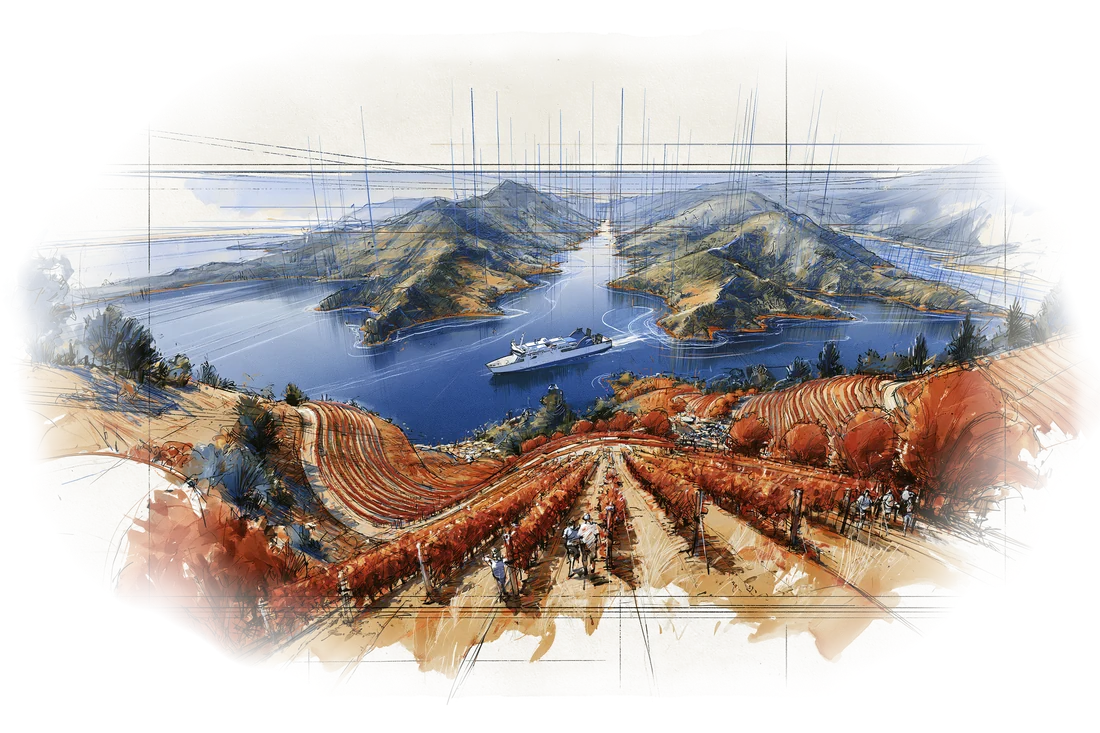
Coming out of the Buller Gorge, the road over from Murchison drops into a long, flat valley and the country changes again. The rainforest is gone, the hills turn dry and tawny, and for the last half hour into Blenheim there's nothing on either side of the highway but vines in ruler-straight rows. This is the Wairau Valley, the heart of Marlborough, and it grows most of the wine New Zealand sends abroad. We give it two nights, one afternoon of cellar doors, and then the ferry north.
A young wine region
The wine story here is short. A settler planted a few vines south of Blenheim in the 1870s, but for the next century the valley mostly grew sheep, grain and fruit. Then in 1973 Montana Wines, the country's biggest producer, planted the first large commercial vineyards here, and sauvignon blanc went in a couple of years later.
The turning point came in 1985, when the Australian winemaker David Hohnen founded Cloudy Bay, named for the bay James Cook charted on this coast in 1770. Its first sauvignon blanc, made by Kevin Judd, caused a small sensation in London: loud, zesty and green, nothing like the restrained whites of the Loire. Within a few years "New Zealand" and "sauvignon blanc" meant much the same thing to wine drinkers overseas. Cloudy Bay has been owned by LVMH since 2003.
Today the region has close to 28,000 hectares of vines, about 70% of the national total, and produces roughly three-quarters of the country's wine and 85% of its exports. More than four-fifths of what's planted here is sauvignon blanc. Pinot noir, chardonnay and sparkling wine fill most of the rest.
Why it tastes the way it does
Three things make it work. Sun: Blenheim is regularly the sunniest town in New Zealand, with around 2,500 hours a year. Cold nights: summer days are warm but the nights cool sharply, so the grapes ripen slowly and keep their acidity. And gravel: the Wairau River has spread stones across the valley floor for millennia, and those free-draining soils keep the vines lean.
The result is the house style people either love or find too much: passionfruit, grapefruit and gooseberry, a sharp green note of cut grass or capsicum, and acidity that makes your mouth water. The cooler, windier Awatere Valley to the south makes saltier, more herbal versions, and the clay-soiled Southern Valleys grow much of the pinot noir.
Blenheim and Picton
Blenheim, with about 30,000 people, is a flat, sunny service town for the vineyards: a good place for breakfast, a supermarket run and an early night.
Picton, half an hour north, is the other end of the funnel. It's a small harbor town at the head of Queen Charlotte Sound that lives largely off the ferries. The morning of the crossing leaves time for the short, steep Tirohanga Track to a lookout over the town and the sound, or for the Edwin Fox, an 1853 sailing ship that sits in a dry dock on the foreshore and is one of the oldest surviving merchant ships in the world.
The Marlborough Sounds
North of Picton the land breaks up into the Marlborough Sounds, a maze of long, forested inlets and islands with roughly 1,500 km of shoreline. They look like fiords but aren't. These are drowned river valleys: the land has been slowly sinking, and when the seas rose after the last ice age they flooded the valleys and left only the ridgelines showing. Cook anchored in Queen Charlotte Sound on all three of his Pacific voyages. Most of the country's green-lipped mussels are farmed in these waters.
Crossing Cook Strait
The Interislander ferry leaves Picton, runs out along Queen Charlotte Sound and turns into Tory Channel, a narrow, 17 km arm of the sounds between the mainland and Arapaoa Island. Stay on deck for this part: the hills close in on both sides, holiday cottages sit alone in the bays, and dolphins are a regular sight. Near the far end is the old Perano whaling station, which closed in 1964, the last in New Zealand. Then the ship makes a hard turn through the narrow gap between the heads of the channel, and all at once you are out in Cook Strait.
The strait is only about 22 km wide at its narrowest, but it funnels the wind between the two islands and has a reputation as one of the roughest stretches of water anywhere. On a calm summer afternoon it can be glassy; on a bad one the ship rolls, and the place to be is low and amidships with your eyes on the horizon. The whole trip is about 92 km and takes around 3.5 hours. It ends by passing the Pencarrow lighthouse into Wellington Harbour, with the capital spread across the hills ahead.
Since the older Aratere retired in August 2025, the route runs on two ships until new ones arrive in 2029. Ours is Kaitaki, built in 1995 as an Irish Sea ferry and carrying up to 1,350 passengers; its partner is Kaiārahi, "the leader."
A valley full of vines, a coast of drowned valleys, and then the open strait.
从布勒峡谷出来,过了默奇森,路往下一沉,落进一条又长又平的河谷,风景又换了一副面孔。雨林不见了,两边的山变得干燥、泛着黄褐色,光线一下子硬朗起来。进布莱尼姆之前的最后半个钟头,公路两侧除了葡萄藤什么都没有,一行一行直得像用尺子画出来的。这里是怀劳河谷(Wairau Valley),马尔堡的心脏,新西兰卖到海外的葡萄酒,大半出自这里。我们在这儿住两晚,花一个下午逛酒庄,然后搭渡轮北上。
一个年轻的产区
马尔堡的酿酒史短得出人意料。19 世纪 70 年代,有移民在布莱尼姆南边种过几株葡萄,后来不了了之。之后差不多一百年,河谷里主要是养羊,种粮食和果树。直到 1973 年,当时全国最大的酒商 Montana 在这里种下第一批大规模的商业葡萄园,两年后又种上了长相思(sauvignon blanc)。
真正的转折在 1985 年。澳大利亚酿酒师大卫·霍宁创办了云雾之湾(Cloudy Bay),酒庄名取自 1770 年库克船长在这段海岸标下的海湾。酒庄头一款长相思由凯文·贾德酿造,在伦敦引起不小的轰动:香气张扬、酸度利落、带着一股青草气,和卢瓦尔河谷那种内敛的白葡萄酒完全是两回事。没过几年,在海外的酒客心里,“新西兰”和“长相思”几乎成了同义词。2003 年起,云雾之湾归 LVMH 所有。
如今马尔堡的葡萄园接近 2.8 万公顷,占全国的七成左右,产量约占全国四分之三,出口更占到八成五。这里种下的葡萄,八成以上是长相思;剩下的大多是黑皮诺、霞多丽、灰皮诺,还有品质相当不错的起泡酒。
这个味道从哪里来
成就马尔堡的,是三样东西。一是日照。布莱尼姆常年是新西兰日照最多的城镇,一年大约 2500 小时,有些年份还要多出不少。二是凉夜。夏天白天暖和,夜里却凉得很快,葡萄因此熟得慢,酸度也留得住。三是土地。怀劳河用了几千年,把卵石和砾石铺满整个河谷底,这样排水极好的土壤,让葡萄藤长得精瘦。
结果就是那种要么让人着迷、要么让人嫌太冲的招牌风格:百香果、西柚、醋栗,一丝割过的青草或青椒的气味,外加让人口舌生津的酸。南边的阿沃特尔河谷(Awatere Valley)更凉、风更大,酒更咸、更偏草本;南部河谷(Southern Valleys)是伸进威瑟山的几条黏土小谷,马尔堡的黑皮诺多半出在那里。
布莱尼姆和皮克顿
布莱尼姆人口三万上下,地势平坦、阳光充足,是给葡萄园配套的小城:吃早饭、逛超市补给、早点睡觉,都很合适。
往北半小时是皮克顿,整趟南岛行程在这里收口。它是夏洛特女王峡湾顶端的一座港口小镇,说它因渡轮而存在也不为过。过海那天上午,时间够走一趟又短又陡的 Tirohanga 步道,登上观景台俯瞰小镇和峡湾;或者去海边看看 Edwin Fox 号,一艘 1853 年造的帆船,如今架在岸边的干船坞里,是世界上现存最古老的商船之一。
马尔堡峡湾
皮克顿以北,陆地碎成马尔堡峡湾:一片由狭长的森林水湾和岛屿交织成的迷宫,海岸线长约 1500 公里。它看起来像峡湾,成因却不一样。这里其实是被海水淹没的河谷:这片陆地一直在缓慢下沉,末次冰期之后海平面上涨,海水灌进河谷,只把山脊留在水面上。库克船长三次太平洋远航,每一次都在夏洛特女王峡湾下过锚。全国菜单上的青口贻贝,大多也是在这片水域养出来的。
横渡库克海峡
岛际渡轮从皮克顿出发,顺着夏洛特女王峡湾驶出,再拐进托里水道(Tory Channel)。这条水道长约 17 公里,夹在南岛本土和阿拉帕奥阿岛之间。这一段一定要待在甲板上:两岸的山压得很近,度假小屋一栋一栋孤零零地守着各自的海湾,海豚也常能见到。快到出口的地方,是早已废弃的佩拉诺捕鲸站,1964 年关停,是新西兰最后一座捕鲸站。接着船身一个急转,从两座岬角之间的窄口挤出去,眼前豁然开阔,已经是库克海峡了。
海峡最窄处只有 22 公里左右,却是南北两岛之间的风口,素来被看作世界上最难走的水域之一。夏天风平浪静的下午,海面可以平得像镜子;赶上坏天气,船会晃得厉害,最明智的位置是船舱中部、低层,眼睛盯住海平线。全程大约 92 公里,约 3 个半小时,最后经过 Pencarrow 灯塔驶入惠灵顿港,首都就铺在前方的山坡上。
老船 Aratere 号 2025 年 8 月退役之后,新船 2029 年到位之前,这条航线只靠两艘船撑着。我们坐的是 Kaitaki 号,两艘里较大的那艘,1995 年造,原本跑爱尔兰海航线,最多能载 1350 名乘客。另一艘是 Kaiārahi 号,毛利语意思是“引路人”。
一条种满葡萄的河谷,一片被海水淹没的河谷,然后是开阔的海峡。
Where this shows up on the trip行程里对应的日子