On the road · 5 min read在路上 · 约 5 分钟
Driving New Zealand新西兰自驾
Most of this trip happens behind a windshield. New Zealand's roads are beautiful, mostly quiet and easy to navigate, but they are also narrow, winding and unforgiving in ways that catch visitors out. A few habits make the difference between a relaxed road trip and a stressful one.
Keep left, and slow down more than the map says
New Zealand drives on the left, with the driver on the right side of the car. The hard moments are turning onto an empty road (look right first, then pull into the left lane), roundabouts (go clockwise and give way to traffic from your right) and the first few minutes after every stop. A useful trick: the driver's body should always be toward the center line.
The open-road speed limit is usually 100 km/h, with some expressways at 110, but the real speed is set by the road. State highways are often a single lane each way, with tight curves, no shoulder and a drop to one side. Google Maps is honest about times, and most of our drive times are longer than the distances suggest:
- Queenstown → Te Anau: about 170 km, 2 hours
- Te Anau → Milford Sound: about 120 km, 2 hours without stops (plan on 3 to 4 with them)
- Wānaka → Aoraki/Mount Cook Village: about 2.5 hours
- Twizel → Hokitika over Arthur's Pass: about 480 km, a full day with stops
- Hokitika → Punakaiki → Buller Gorge → Blenheim: about 420 km, another full day
- Blenheim → Picton: about 30 minutes
- Wellington → National Park Village (Tongariro): about 4 hours
- Taupō → Rotorua: about 1 hour; Rotorua → Auckland: about 3 hours
Other rules: no phone in your hand while driving (hands-free only), seat belts for everyone, and a low blood-alcohol limit (0.05% for drivers 20 and over). Long summer evenings help: in late January, the South Island doesn't get dark until after 9 p.m.
One-lane bridges
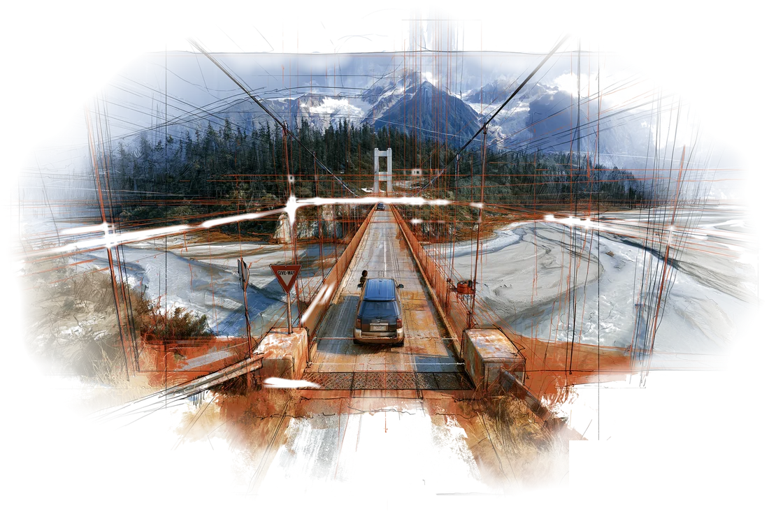
New Zealand has hundreds of single-lane bridges, especially on the West Coast and in the Southern Alps. Each one is signposted in advance. A blue rectangular sign where your direction has the big white arrow means you have priority. A red circle where your direction has the small red arrow means you give way to oncoming traffic. Either way, slow down and look across the whole bridge; if anything is coming or already on it, wait.
Gravel, livestock and weather
Some side roads are unsealed (gravel). Take them slowly (loose stones behave like ball bearings), keep well back from the car in front, and check your rental agreement: many forbid certain gravel roads, like Skippers Canyon near Queenstown. Watch for sheep or cattle being moved along rural roads; stop and let them pass. In the mountains, check road status before you go. The Milford Road and Arthur's Pass can close for rockfall, snow or storms even in summer. The official source is the NZ Transport Agency's journey planner and road-status page.
Campervans and courtesy
You'll share the road with a lot of campervans, many driven by visitors still getting used to the left side. The unspoken rules:
- Use the pull-over bays. If three or four cars are lining up behind you, pull over when it's safe and let them pass. Kiwis consider it basic manners.
- Use passing lanes rather than overtaking on a blind curve. They come up regularly on main highways.
- Don't stop on the road for photos. Find a proper pull-off. The number of people who stop in a live lane to photograph Lake Pukaki or a snowy peak is a real hazard.
- A lifted finger from the steering wheel to oncoming drivers on back roads is the local wave.
Fuel
Gas is "petrol" here, sold as 91 or 95 unleaded, plus diesel. Most stations are pay-at-pump with a card, including some staffless 24-hour stations. Stations thin out in remote areas, so the rule is simple: fill up before any long, empty stretch. Top up in Te Anau before the Milford Road (there's no fuel at Milford Sound), before Arthur's Pass, and before the long drives on the West Coast. Rental cars usually need to be returned full.
Crossing Cook Strait: the Interislander
To get from the South Island to the North, we take the Interislander ferry from Picton to Wellington, a 92 km crossing of about 3.5 hours. Roughly the first hour winds out through the Queen Charlotte Sound and the narrow Tory Channel in the Marlborough Sounds, with forested hills close on both sides; dolphins are often seen. Then comes the open water of Cook Strait, where the Tasman Sea meets the Pacific. It can be smooth, or it can be one of the roughest short crossings in the world, so take seasickness tablets on a windy day. The last stretch sweeps into Wellington Harbour, with the city on its hills.
The Interislander fleet is currently Kaitaki and Kaiārahi; the older Aratere retired in August 2025, and new ships are due around 2029. Bluebridge runs the same route.
The catch is usually the rental car. Many rental companies don't allow their cars on the ferry; you return the car in Picton, cross on foot and pick up another in Wellington. Ours is different: the SUV is booked one-way from Queenstown to Auckland and crosses with us on Kaitaki, booked as a vehicle on the same ticket. Vehicle check-in at Picton closes about an hour before sailing, so aim to be in the lane early.
On a road this narrow, a red arrow and a pull-over bay matter more than the speed limit.
这趟旅行,大半时间是隔着挡风玻璃度过的。新西兰的路很美,大多清静,也不难认,但路窄、弯多,出了错没有多少回旋余地,外国游客常在这上头吃亏。养成几个习惯,自驾就能从提心吊胆变成从从容容。
靠左行驶,车速比地图上想的再慢一点
新西兰靠左行驶,驾驶座在右边。最容易出错的是这几个时刻:从路口拐上一条空荡荡的路(先看右边,然后开进左侧车道);环岛(顺时针绕行,让右侧来车先行);以及每次停车之后重新上路的头几分钟。有个小诀窍:司机的身体,永远应该挨着道路中线那一侧。
开阔路段的限速一般是每小时 100 公里,个别快速路是 110,但真正决定车速的是路本身。国道往往是双向各一条车道,弯急、没有路肩,一侧就是陡坡。谷歌地图给的时间是老实的,我们这趟大多数路段,花的时间都比里程看上去要长:
- 皇后镇 → 蒂阿瑙:约 170 公里,2 小时
- 蒂阿瑙 → 米尔福德峡湾:约 120 公里,不停车 2 小时(算上沿途停留,按 3 到 4 小时计划)
- 瓦纳卡 → 奥拉基/库克山村:约 2.5 小时
- 特威泽尔 → 霍基蒂卡,翻越亚瑟隘口:约 480 公里,连停带看,一整天
- 霍基蒂卡 → 普纳凯基 → 布勒峡谷 → 布莱尼姆:约 420 公里,又是一整天
- 布莱尼姆 → 皮克顿:约 30 分钟
- 惠灵顿 → 国家公园村(汤加里罗):约 4 小时
- 陶波 → 罗托鲁瓦:约 1 小时;罗托鲁瓦 → 奥克兰:约 3 小时
其他规矩:开车时手里不能拿手机(只能用免提),全车都要系安全带,酒驾标准很严(20 岁及以上司机血液酒精含量上限 0.05%)。夏天白昼长是个好处:一月下旬,南岛要到晚上九点以后才天黑。
单车道桥
新西兰有几百座单车道桥,西海岸和南阿尔卑斯山区尤其多。每座桥前面都有提前预告的标志。蓝色方牌上,如果你这个方向是大白箭头,说明你有优先权;红圈牌上,如果你这个方向是小红箭头,就得让对向来车先过。不管哪种,都先减速,把整座桥看一遍;只要对面有车过来或已经上了桥,就等着。
碎石路、牛羊与天气
有些支路是未铺装的碎石路。慢慢开(松动的石子就像滚珠),和前车拉开距离,并且看清租车合同:很多合同明确禁止开某些碎石路,比如皇后镇附近的 Skippers Canyon。乡间路上碰到赶羊赶牛的,停车让它们先过。进山之前查一下路况,米尔福德公路和亚瑟隘口即便在夏天,也会因为落石、降雪或暴雨封路。权威信息看新西兰交通局(NZ Transport Agency)的行程规划和路况页面。
房车与路上的礼数
路上会遇到大量房车,不少司机和你一样,还在适应靠左开。几条不成文的规矩:
- 用好让车带。 如果身后排了三四辆车,找安全的地方靠边,让它们先过。新西兰人认为这是基本礼貌。
- 用超车道超车,别在看不见前方的弯道上硬超。主要国道上每隔一段就有一条。
- 不要在路中间停车拍照。 找正规的路边停车点。在行车道上一脚刹车停下来拍普卡基湖或雪山的人,多到构成了真实的安全隐患。
- 在乡间小路上,对面来车时从方向盘上抬一根手指,就是当地人打招呼的方式。
加油
汽油这里叫 petrol,分 91 和 95 无铅,另有柴油。大多数加油站可以在油枪旁直接刷卡,有些还是 24 小时无人值守。偏远地区加油站稀少,所以规矩很简单:任何一段又长又荒的路之前,先加满。开米尔福德公路前在蒂阿瑙加满(米尔福德峡湾没有加油站),翻亚瑟隘口前加满,西海岸的长途段之前也加满。租来的车通常要满油归还。
横渡库克海峡:Interislander 渡轮
从南岛到北岛,我们坐 Interislander 渡轮,从皮克顿到惠灵顿,航程 92 公里,约 3.5 小时。前面大约一个小时,船在马尔堡峡湾里穿行,经过夏洛特女王峡湾和狭窄的托里水道,两岸长满树的山坡近在眼前,常能看到海豚。接下来就是开阔的库克海峡,塔斯曼海和太平洋在这里交汇。海面可能风平浪静,也可能是世界上最颠的短途航线之一,风大的日子记得吃晕船药。最后一段,船驶进惠灵顿港,城市就铺在港湾四周的山坡上。
Interislander 眼下的船队是 Kaitaki 号和 Kaiārahi 号;老船 Aratere 号已于 2025 年 8 月退役,新船预计 2029 年前后到位。另一家 Bluebridge 也跑同一条航线。
麻烦通常出在租来的车上。不少租车公司不允许车上渡轮,得在皮克顿还车,步行过海,到惠灵顿再提一辆。我们这辆不用换:SUV 是从皇后镇到奥克兰的单程租车,跟我们一起上 Kaitaki 号,车辆和人订在同一张船票上。皮克顿的车辆登船大约在开船前一小时截止,最好早点去排队。
在这么窄的路上,一个红箭头和一处让车带,比限速牌更要紧。
Where this shows up on the trip行程里对应的日子